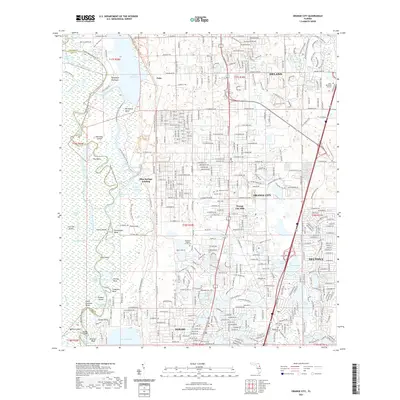
2021 Map of Orange City
USGS Topo · Published 2021About this map
The Saint Johns River corridor anchors this landscape, defining a complex network of wetlands and islands including Hontoon Island and Beresford Peninsula. This 2021 survey reveals a stark contrast between the preserved natural hydrology of Blue Spring State Park and the sprawling residential developments of Deltona and Debary. While Lake Beresford and Blue Springs Run represent the region's historic river-based economy and ecology, the growth of inland communities like Orange City Hills and the southern reaches of DeLand show modern urbanization. Cultural and genealogical markers are frequent, with several burial sites noted such as Missionary Baptist Church Cem, Hollywood Cem, and Evergreen Cem. The map traces the intricate water routes of the Snake Creek Cutoff and Starks Cutoff, providing a modern look at the shifting bends of the river, from Dutchmans Bend to Coxetters Bend.
Find a feature on this map
142 named features on this map. Tap any name to fly to it.
Don’t see what you’re looking for? This feature index may not catch every label — zoom into the map to look around manually.
Map Details
Editions of this 2021 Orange City Map
This is the sole edition of this map. No revisions or reprints were ever made.
Other maps of this area

1954 · Daytona Beach
USGS Topo · 1:250,000

1955 · Orlando
USGS Topo · 1:250,000

1957 · Orlando
USGS Topo · 1:250,000

1958 · Orlando
USGS Topo · 1:250,000

1958 · Daytona Beach
USGS Topo · 1:250,000

1962 · Orlando
USGS Topo · 1:250,000

1962 · Pine Lakes
USGS Topo · 1:24,000

1962 · Daytona Beach SW
USGS Topo · 1:24,000

1962 · Lake Woodruff
USGS Topo · 1:24,000

1964 · Daytona Beach
USGS Topo · 1:250,000