
1962 Map of Pine Lakes
USGS Topo · Published 1963About this map
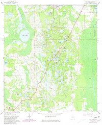
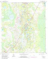
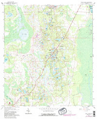
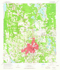
The settlement of Cassia and its accompanying Cassia Cem anchor the southwestern corner of this 1962 topographical study, located where the sand hills of the Ocala National Forest transition toward the St. Johns River. This landscape is defined by an intricate network of sinkhole lakes and ponds, including Lake Tracy, St Claire Lake, and the cluster at Pine Lakes. The presence of an Old Railroad Grade slicing through the eastern portion of the quadrangle reveals the path of former timber or agricultural commerce that once linked this interior region to river landings like Crows Bluff.
Find a feature on this map
52 named features on this map. Tap any name to fly to it.
Don’t see what you’re looking for? This feature index may not catch every label — zoom into the map to look around manually.
Map Details
Editions of this 1962 Pine Lakes Map
4 editions found
Other maps of this area

1954 · Daytona Beach
USGS Topo · 1:250,000

1955 · Orlando
USGS Topo · 1:250,000

1957 · Orlando
USGS Topo · 1:250,000

1958 · Orlando
USGS Topo · 1:250,000

1958 · Daytona Beach
USGS Topo · 1:250,000

1960 · Sorrento
USGS Topo · 1:24,000

1962 · Orlando
USGS Topo · 1:250,000

1962 · Lake Woodruff
USGS Topo · 1:24,000

1964 · Daytona Beach
USGS Topo · 1:250,000
1964 · De Land
USGS Topo · 1:24,000