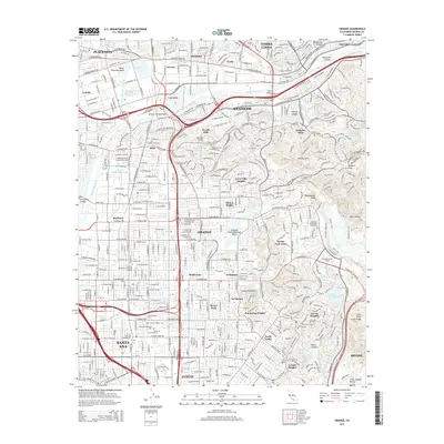
2015 Map of Orange
USGS Topo · Published 2015About this map
The Santa Ana River carves through the center of this dense Southern California landscape, dividing the metropolitan centers of Anaheim and Orange from the residential heights to the east. Extensive water management infrastructure is evident throughout the corridor, including the Miller Retarding Basin, Anaheim Lake, and the complex network of the Santa Ana-Valley Canal and Anaheim Union Canal. These features highlight the region's historic transition from an agricultural powerhouse to a major urban hub.
Find a feature on this map
83 named features on this map. Tap any name to fly to it.
Don’t see what you’re looking for? This feature index may not catch every label — zoom into the map to look around manually.
Map Details
Editions of this 2015 Orange Map
This is the sole edition of this map. No revisions or reprints were ever made.
Other maps of this area

1896 · Santa Ana
USGS Topo · 1:62,500

1896 · Anaheim
USGS Topo · 1:62,500

1898 · Anaheim
USGS Topo · 1:62,500

1901 · Southern California Sheet No. 1
USGS Topo · 1:250,000

1901 · Santa Ana
USGS Topo · 1:62,500

1901 · Anaheim
USGS Topo · 1:62,500

1902 · Corona
USGS Topo · 1:125,000

1904 · Southern California Sheet No. 1
USGS Topo · 1:250,000

1932 · Orange
USGS Topo · 1:31,680

1932 · Newport Beach
USGS Topo · 1:31,680