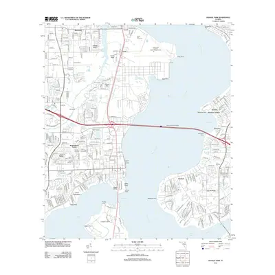
2012 Map of Orange Park
USGS Topo · Published 2012About this map
The Saint Johns River dominates this landscape, serving as a massive geographical divide between the suburban developments of Mandarin and the industrial and military corridors of the west bank. On the northwestern shore, the Jacksonville Naval Air Station (Towers Field) stands as a major landmark near Yukon and Dewey Park, while the Henry H Buckman Bridge provides the critical transit link across the wide waterway. Genealogists and local historians can locate several burial grounds, including Magnolia Cem near Johnson Slough and Mandarin Cem on the eastern peninsula. The transition from Duval County into Clay County is evident near Bellair, illustrating the southward expansion of the Jacksonville metropolitan area. Significant water features like Doctors Lake and Ortega River define the local neighborhoods, from the waterfront properties of Venetia to the winding creeks of East Mandarin.
Find a feature on this map
61 named features on this map. Tap any name to fly to it.
Don’t see what you’re looking for? This feature index may not catch every label — zoom into the map to look around manually.
Map Details
Editions of this 2012 Orange Park Map
This is the sole edition of this map. No revisions or reprints were ever made.
Other maps of this area

1917 · Orange Park
USGS Topo · 1:62,500

1917 · Cambon
USGS Topo · 1:62,500

1918 · Middleburg
USGS Topo · 1:62,500

1918 · Cambon
USGS Topo · 1:62,500

1918 · Jacksonville
USGS Topo · 1:62,500

1918 · Orange Park
USGS Topo · 1:62,500

1941 · Middleburg
USGS Topo · 1:62,500

1948 · Jacksonville
USGS Topo · 1:250,000

1949 · Middleburg
USGS Topo · 1:24,000

1949 · Jacksonville Heights
USGS Topo · 1:24,000