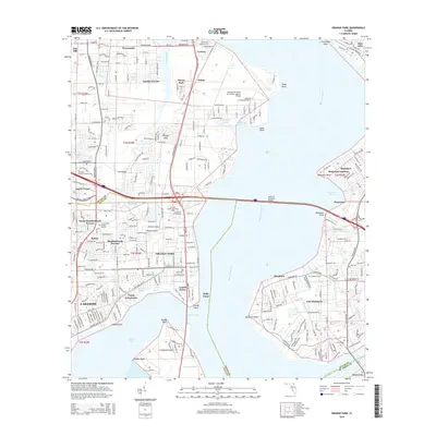
2015 Map of Orange Park
USGS Topo · Published 2015About this map
Orange Park and the surrounding neighborhoods of Lakeside and Mandarin sit at a significant geographical bend in the Saint Johns River, where the Henry H Buckman Bridge connects these established communities. The landscape is defined by its suburban layout interwoven with coastal inlets like Doctors Lake and Moccasin Slough. A major military presence is visible at the Jacksonville Naval Air Station (Towers Field) near Yukon, shaping the development and infrastructure of the northern portion of the quadrangle.
Find a feature on this map
71 named features on this map. Tap any name to fly to it.
Don’t see what you’re looking for? This feature index may not catch every label — zoom into the map to look around manually.
Map Details
Editions of this 2015 Orange Park Map
This is the sole edition of this map. No revisions or reprints were ever made.
Other maps of this area

1917 · Orange Park
USGS Topo · 1:62,500

1917 · Cambon
USGS Topo · 1:62,500

1918 · Middleburg
USGS Topo · 1:62,500

1918 · Cambon
USGS Topo · 1:62,500

1918 · Jacksonville
USGS Topo · 1:62,500

1918 · Orange Park
USGS Topo · 1:62,500

1941 · Middleburg
USGS Topo · 1:62,500

1948 · Jacksonville
USGS Topo · 1:250,000

1949 · Middleburg
USGS Topo · 1:24,000

1949 · Jacksonville Heights
USGS Topo · 1:24,000