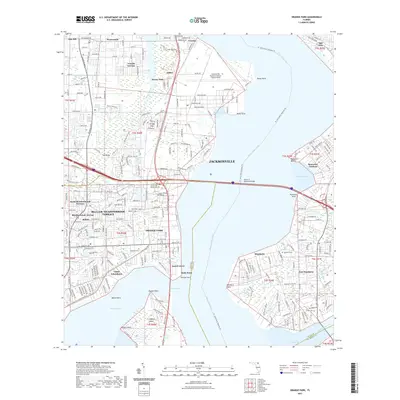
2021 Map of Orange Park
USGS Topo · Published 2021About this map
Jacksonville Naval Air Station (Towers Field) dominates the northern landscape of this survey, with its runways and complex grid of patrol and enterprise roads overlooking the Saint Johns River. Further south, the town of Orange Park and the residential neighborhoods of Bellair-Meadowbrook Terrace line the western shore of Doctors Lake. The topography reveals a transition from these established suburban developments to the more verdant eastern bank of the river, where settlements like Mandarin and East Mandarin retain their distinct character.
Find a feature on this map
192 named features on this map. Tap any name to fly to it.
Don’t see what you’re looking for? This feature index may not catch every label — zoom into the map to look around manually.
Map Details
Editions of this 2021 Orange Park Map
This is the sole edition of this map. No revisions or reprints were ever made.
Other maps of this area

1917 · Orange Park
USGS Topo · 1:62,500

1917 · Cambon
USGS Topo · 1:62,500

1918 · Middleburg
USGS Topo · 1:62,500

1918 · Cambon
USGS Topo · 1:62,500

1918 · Jacksonville
USGS Topo · 1:62,500

1918 · Orange Park
USGS Topo · 1:62,500

1941 · Middleburg
USGS Topo · 1:62,500

1948 · Jacksonville
USGS Topo · 1:250,000

1949 · Middleburg
USGS Topo · 1:24,000

1949 · Jacksonville Heights
USGS Topo · 1:24,000