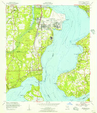
1952 Map of Orange Park
USGS Topo · Published 1956About this map
The St Johns River dominates this mid-century portrait of Clay and Duval counties, where the sprawling Jacksonville Naval Air Station stands as a massive military presence at Black Point. The landscape reflects a mix of growing suburban nodes and older riverfront settlements like Orange Park and Mandarin. Along the western bank, the Atlantic Coast Line railroad runs parallel to the river, servicing communities from Yukon down through the narrow passage at Doctors Inlet.
Find a feature on this map
60 named features on this map. Tap any name to fly to it.
Don’t see what you’re looking for? This feature index may not catch every label — zoom into the map to look around manually.
Map Details
Editions of this 1952 Orange Park Map
This is the sole edition of this map. No revisions or reprints were ever made.
Other maps of this area

1917 · Orange Park
USGS Topo · 1:62,500

1917 · Cambon
USGS Topo · 1:62,500

1918 · Middleburg
USGS Topo · 1:62,500

1918 · Cambon
USGS Topo · 1:62,500

1918 · Jacksonville
USGS Topo · 1:62,500

1918 · Orange Park
USGS Topo · 1:62,500

1941 · Middleburg
USGS Topo · 1:62,500

1948 · Jacksonville
USGS Topo · 1:250,000

1949 · Middleburg
USGS Topo · 1:24,000

1949 · Jacksonville Heights
USGS Topo · 1:24,000