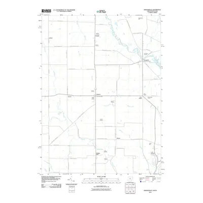
2010 Map of Orangeville
USGS Topo · Published 2010About this map
Orangeville sits at the eastern edge of this landscape, straddling the state line where the Shenango River Lake and Pymatuning Creek converge. This 2010 survey reveals a community structure deeply tied to historical burial grounds and rural hubs, including Burghill Cemetery and the West Street Cemetery. The terrain is defined by the drainage patterns of Yankee Run and McCullough Run, which cut through a mosaic of agricultural land and small airstrips like Port Sember Airport. Local commerce and social centers are anchored by landmarks such as the Burghill Post Office and the Sharon Speedway. For genealogists, the map provides a precise layout of several family and community graveyards, including the Artherholt Cemetery and Hartford Center Cemetery, alongside established settlements like Latimer, Weldon, and Five Points.
Find a feature on this map
60 named features on this map. Tap any name to fly to it.
Don’t see what you’re looking for? This feature index may not catch every label — zoom into the map to look around manually.
Map Details
Editions of this 2010 Orangeville Map
This is the sole edition of this map. No revisions or reprints were ever made.
Other maps of this area

1905 · Neshannock
USGS Topo · 1:62,500

1906 · Youngstown
USGS Topo · 1:62,500

1907 · Neshannock
USGS Topo · 1:62,500

1907 · Kinsman
USGS Topo · 1:62,500

1908 · Shenango
USGS Topo · 1:62,500

1908 · Youngstown
USGS Topo · 1:62,500

1950 · Cleveland
USGS Topo · 1:250,000

1954 · Sharon West
USGS Topo · 1:24,000

1954 · Girard
USGS Topo · 1:24,000

1956 · Cleveland
USGS Topo · 1:250,000