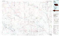
1985 Map of Ord
USGS Topo · Published 1985About this map
The North Loup River and Cedar River carve a path through the Nebraska sandhills region, defining a landscape of irrigation and rail-connected settlements in the mid-1980s. The Union Pacific railroad serves as the primary spine for commerce, linking the county seats of Ord and Albion. This survey documents a critical period of water management in the region, evidenced by the Loup River Canal and several Gaging Stations along the winding waterways. Small agricultural hubs like Spalding, Greeley, and Petersburg are depicted alongside local landmarks such as Pilot Knob and the Pibel Lake State Recreation Area. For those tracing local history, the map includes numerous Cemeteries and smaller communities like Raeville and Primrose, providing a clear record of the rural population distribution and infrastructure before the turn of the 21st century.
Find a feature on this map
55 named features on this map. Tap any name to fly to it.
Don’t see what you’re looking for? This feature index may not catch every label — zoom into the map to look around manually.
Map Details
Editions of this 1985 Ord Map
2 editions found
Other maps of this area

1896 · Stromsburg
USGS Topo · 1:125,000

1899 · Loup
USGS Topo · 1:125,000

1899 · St. Paul
USGS Topo · 1:125,000

1951 · Arcadia East
USGS Topo · 1:24,000

1952 · Elyria
USGS Topo · 1:24,000

1952 · Burwell SE
USGS Topo · 1:24,000

1952 · Burwell NE
USGS Topo · 1:24,000

1952 · Comstock SE
USGS Topo · 1:24,000

1953 · Loup City NW
USGS Topo · 1:24,000

1953 · North Loup
USGS Topo · 1:24,000