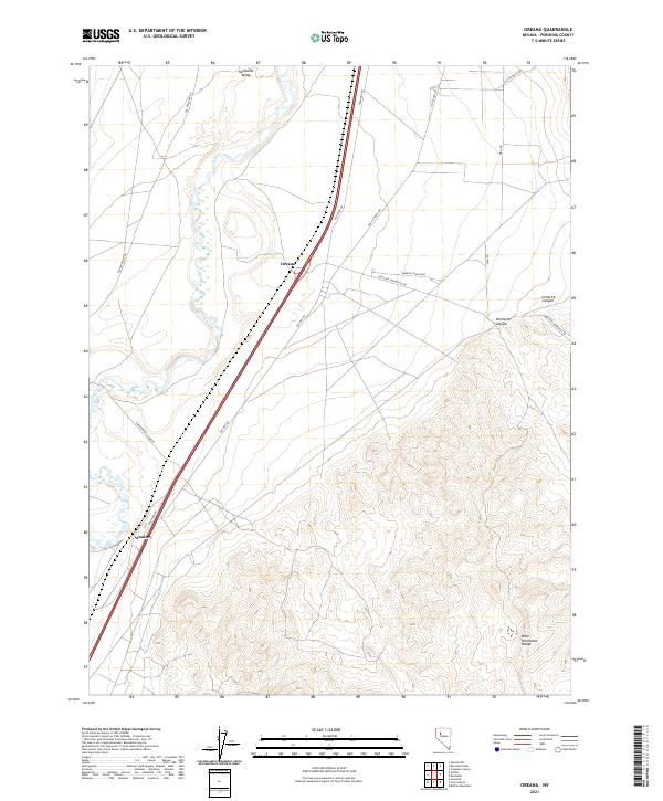
2021 Map of Oreana
USGS Topo · Published 2021About this map
The Humboldt Valley floor gives way to the rising slopes of the West Humboldt Range in this portion of Pershing County. This corridor represents a significant historical transit artery, where modern infrastructure follows the same natural contours once traced by pioneers. The map captures the small settlements of Oreana and Woolsey, positioned along a complex network of thoroughfares including Old Hwy 40 and the Old Emigrant Rd.
Find a feature on this map
19 named features on this map. Tap any name to fly to it.
Don’t see what you’re looking for? This feature index may not catch every label — zoom into the map to look around manually.
Map Details
Editions of this 2021 Oreana Map
This is the sole edition of this map. No revisions or reprints were ever made.
Other maps of this area

1931 · Lovelock
USGS Topo · 1:250,000

1935 · Lovelock
USGS Topo · 1:250,000

1954 · Unionville
USGS Topo · 1:62,500

1954 · Buffalo Mtn
USGS Topo · 1:62,500

1955 · Lovelock
USGS Topo · 1:250,000

1956 · Oreana
USGS Topo · 1:62,500

1956 · Lovelock
USGS Topo · 1:62,500

1959 · Lovelock
USGS Topo · 1:250,000

1984 · Lovelock
USGS Topo · 1:100,000
1987 · Rye Patch Dam
USGS Topo · 1:24,000