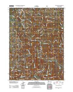
2011 Map of Oregon Caves
USGS Topo · Published 2011About this map
Mining history and high-elevation terrain define this 2011 survey of the Siskiyou National Forest along the Oregon and California border. Several historic workings appear throughout the drainages, including the Tip Top Mine, Rainbow Mine, and Edmonds Mine, indicating a long-standing tradition of extraction in the steep gulches surrounding Althouse Creek. The landscape is a network of named waters like Sucker Creek and Yeager Creek, interspersed with isolated structures such as the Rasmussen House and Fulk Cabin. These small settlements and cabins, often situated near water or mine sites, illustrate the remote character of Josephine County's interior. Notable geographic landmarks like Big Tree and Bolan Lake offer points of interest for those tracking family land use or regional history in the Klamath Mountains.
Find a feature on this map
84 named features on this map. Tap any name to fly to it.
Don’t see what you’re looking for? This feature index may not catch every label — zoom into the map to look around manually.
Map Details
Editions of this 2011 Oregon Caves Map
This is the sole edition of this map. No revisions or reprints were ever made.
Other maps of this area

1908 · Grants Pass
USGS Topo · 1:125,000

1914 · Seiad
USGS Topo · 1:125,000

1917 · Kerby
USGS Topo · 1:125,000

1918 · Kerby
USGS Topo · 1:125,000

1922 · Preston Peak
USGS Topo · 1:125,000

1922 · Seiad
USGS Topo · 1:125,000

1945 · Kerby
USGS Topo · 1:125,000

1948 · Weed
USGS Topo · 1:250,000

1950 · Weed
USGS Topo · 1:250,000

1954 · Cave Junction
USGS Topo · 1:62,500