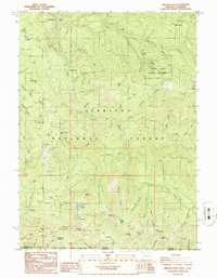
1986 Map of Oregon Caves
USGS Topo · Published 1986About this map
Oregon Caves National Monument sits at the heart of this mid-1980s topographic survey, surrounded by the high peaks and steep drainage basins of the Siskiyou National Forest. The landscape is a complex network of resource extraction and protected wilderness, where mining claims like the Tip Top Mine, Rainbow Mine, and Gypsy Queen Mine appear alongside established landmarks such as Mountain Ranch and China Garden.
Find a feature on this map
77 named features on this map. Tap any name to fly to it.
Don’t see what you’re looking for? This feature index may not catch every label — zoom into the map to look around manually.
Map Details
Editions of this 1986 Oregon Caves Map
This is the sole edition of this map. No revisions or reprints were ever made.
Other maps of this area

1908 · Grants Pass
USGS Topo · 1:125,000

1914 · Seiad
USGS Topo · 1:125,000

1917 · Kerby
USGS Topo · 1:125,000

1918 · Kerby
USGS Topo · 1:125,000

1922 · Preston Peak
USGS Topo · 1:125,000

1922 · Seiad
USGS Topo · 1:125,000

1945 · Kerby
USGS Topo · 1:125,000

1948 · Weed
USGS Topo · 1:250,000

1950 · Weed
USGS Topo · 1:250,000

1954 · Cave Junction
USGS Topo · 1:62,500