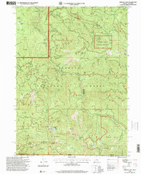
1996 Map of Oregon Caves
USGS Topo · Published 1999About this map
Oregon Caves National Monument anchors this 1996 revision of the Siskiyou high country, where the subterranean wonders of the Monument meet the surface history of extraction and settlement. The map reveals a landscape defined by the drainage of Sucker Creek and its many tributaries, such as No Name Creek and Cohen Creek. Historical mining activity is heavily recorded across these slopes, from the Rainbow Mine and Tip Top Mine in the north to the Gypsy Queen Mine and Kester Mine further south.
Find a feature on this map
93 named features on this map. Tap any name to fly to it.
Don’t see what you’re looking for? This feature index may not catch every label — zoom into the map to look around manually.
Map Details
Editions of this 1996 Oregon Caves Map
This is the sole edition of this map. No revisions or reprints were ever made.
Other maps of this area

1908 · Grants Pass
USGS Topo · 1:125,000

1914 · Seiad
USGS Topo · 1:125,000

1917 · Kerby
USGS Topo · 1:125,000

1918 · Kerby
USGS Topo · 1:125,000

1922 · Preston Peak
USGS Topo · 1:125,000

1922 · Seiad
USGS Topo · 1:125,000

1945 · Kerby
USGS Topo · 1:125,000

1948 · Weed
USGS Topo · 1:250,000

1950 · Weed
USGS Topo · 1:250,000

1954 · Cave Junction
USGS Topo · 1:62,500