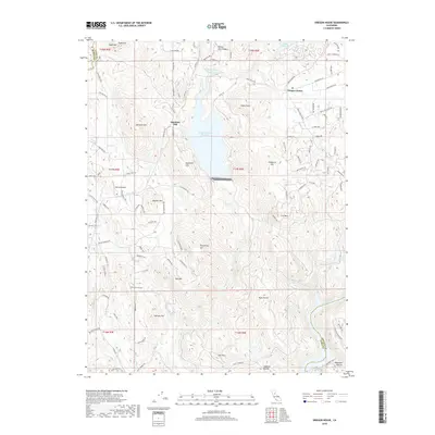
2018 Map of Oregon House
USGS Topo · Published 2018About this map
Virginia Ranch Reservoir dominates the northern landscape of this Yuba County region, its fingers reaching into the foothills near Oregon House. The area is defined by a series of prominent peaks and ridges, including Flanly Peak, Chaparral Hill, and Ure Mtn, which overlook a network of seasonal drainages like Dry Cr and Injun Cr. In the south, the terrain descends toward the Yuba River, where the Keystone Ravine and Hogback Ravine carve steep paths toward the water.
Find a feature on this map
110 named features on this map. Tap any name to fly to it.
Don’t see what you’re looking for? This feature index may not catch every label — zoom into the map to look around manually.
Map Details
Editions of this 2018 Oregon House Map
This is the sole edition of this map. No revisions or reprints were ever made.
Other maps of this area

1888 · Smartsville
USGS Topo · 1:125,000

1891 · Smartsville
USGS Topo · 1:125,000

1892 · Smartsville
USGS Topo · 1:125,000

1894 · Smartsville
USGS Topo · 1:125,000

1895 · Smartsville
USGS Topo · 1:125,000

1911 · Browns Valley
USGS Topo · 1:31,680
1912 · Prairie Creek
USGS Topo · 1:31,680

1941 · Bangor
USGS Topo · 1:62,500

1944 · Bangor
USGS Topo · 1:62,500
1947 · Loma Rica
USGS Topo · 1:24,000