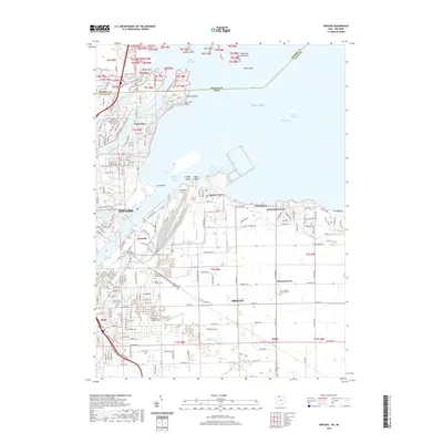
2019 Map of Oregon
USGS Topo · Published 2019About this map
Oregon and the northeastern industrial reaches of Toledo dominate this survey at the western edge of Lake Erie. The landscape is a complex intersection of heavy industry, maritime infrastructure, and historic residential pockets. Extensive drainage systems like Driftmeyer Ditch and Wolf Ditch manage the low-lying terrain, while the Maumee River and Maumee Mooring Basin facilitate the region's shipping economy. Notable industrial and transit features include the Norfolk Southern rail lines and the prominent Presque Isle facility.
Find a feature on this map
155 named features on this map. Tap any name to fly to it.
Don’t see what you’re looking for? This feature index may not catch every label — zoom into the map to look around manually.
Map Details
Editions of this 2019 Oregon Map
This is the sole edition of this map. No revisions or reprints were ever made.
Other maps of this area

1900 · Maumee Bay
USGS Topo · 1:62,500

1900 · Toledo
USGS Topo · 1:62,500

1912 · Monroe
USGS Topo · 1:62,500

1912 · Dundee
USGS Topo · 1:62,500

1914 · Monroe
USGS Topo · 1:62,500

1926 · Dundee
USGS Topo · 1:62,500

1934 · Reno Beach
USGS Topo · 1:24,000

1934 · Point Place
USGS Topo · 1:24,000

1934 · Rossford
USGS Topo · 1:24,000

1935 · Walbridge
USGS Topo · 1:24,000