
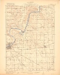
1922 Map of Oregon
USGS Topo · Published 1967About this map
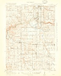
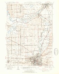
Rock River winds through this Ogle County landscape, serving as a primary geographic anchor for a region defined by its rail connectivity and rural education system. During the early twentieth century, the area was crisscrossed by major rail lines, including the Chicago Milwaukee and St Paul and the Chicago Great Western, which facilitated the growth of established settlements like Mount Morris and Leaf River. The map reveals a dense network of one-room schoolhouses, such as Stonebraker School and Wessels School, illustrating the localized nature of community life before mid-century consolidation. This distribution of schools and churches, including the German Valley Church, reflects a landscape where small-scale social centers were positioned within walking distance of the surrounding farmsteads.
Find a feature on this map
91 named features on this map. Tap any name to fly to it.
Don’t see what you’re looking for? This feature index may not catch every label — zoom into the map to look around manually.
Map Details
Editions of this 1922 Oregon Map
This is the sole edition of this map. No revisions or reprints were ever made.
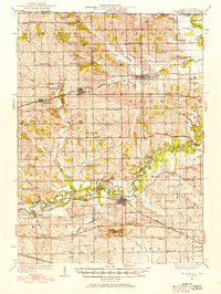
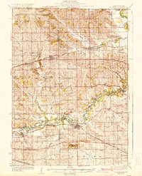
Other maps of this area

1917 · Kings
USGS Topo · 1:62,500

1918 · Rockford
USGS Topo · 1:62,500
1918 · Dixon
USGS Topo · 1:62,500
1918 · Kings
USGS Topo · 1:62,500

1924 · Oregon
USGS Topo · 1:62,500

1930 · Woodsung
USGS Topo · 1:48,000
1932 · Pecatonica
USGS Topo · 1:62,500
1936 · Pecatonica
USGS Topo · 1:62,500
1938 · Rockford
USGS Topo · 1:62,500
1939 · Freeport
USGS Topo · 1:48,000
Featured Places
- Oregon, Oregon - Nashua Township
- Byron, IL
- Mount Morris, Mount Morris Township
- Seward, Seward Township
- Leaf River, Leaf River Township