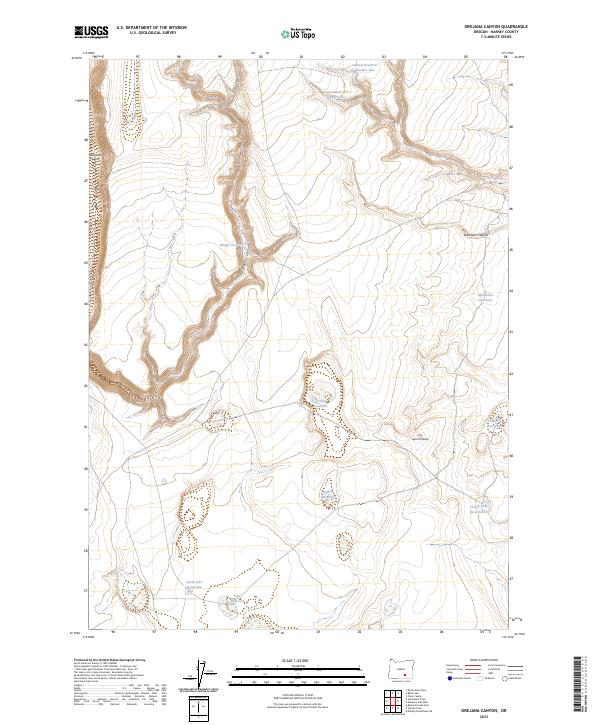
2023 Map of Orejana Canyon
USGS Topo · Published 2023About this map
Orejana Rim dominates the western edge of this High Desert landscape, where the sheer drop into Orejana Canyon creates a stark physical boundary across the high plateau. In this arid reach of Harney County, the distribution of water is the primary footprint of human land use. The map documents a sophisticated network of upland water management, from the Central Reservoir Number One and Central Reservoir Number Two in the north to the South Lake Waterhole at the southern boundary. These named water points, alongside the Cyclone Reservoir and Buffalo Reservoir, indicate the area's ongoing importance for livestock and range management. The terrain is further defined by geologic landmarks like Spine Cob Butte and the deep incisions of Buckhorn Canyon, which provide essential relief in an otherwise expansive, sage-covered environment.
Find a feature on this map
18 named features on this map. Tap any name to fly to it.
Don’t see what you’re looking for? This feature index may not catch every label — zoom into the map to look around manually.
Map Details
Editions of this 2023 Orejana Canyon Map
This is the sole edition of this map. No revisions or reprints were ever made.
Other maps of this area

1955 · Adel
USGS Topo · 1:250,000

1957 · Adel
USGS Topo · 1:250,000

1958 · Adel
USGS Topo · 1:250,000

1962 · Adel
USGS Topo · 1:250,000

1966 · Bluejoint Lake East
USGS Topo · 1:24,000

1971 · Clover Swale
USGS Topo · 1:24,000

1971 · Steamboat Point
USGS Topo · 1:24,000

1971 · Orejana Canyon
USGS Topo · 1:24,000

1971 · Rock Camp Draw
USGS Topo · 1:24,000
1971 · Sixmile Draw
USGS Topo · 1:24,000