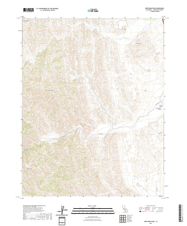
2021 Map of Orestimba Peak
USGS Topo · Published 2021About this map
The Diablo Range dominates this landscape, rising to prominent summits like Orestimba Peak and Black Mtn. The terrain is deeply carved by drainage systems including Crow Cr and Oso Cr, which flow toward the eastern reaches of the Central Valley and San Joaquin Valley. This topographical study reveals the sharp transition from the elevated peaks to the lower flats, a boundary marked by the geologic complexity of the Orestimba Narrows.
Find a feature on this map
20 named features on this map. Tap any name to fly to it.
Don’t see what you’re looking for? This feature index may not catch every label — zoom into the map to look around manually.
Map Details
Editions of this 2021 Orestimba Peak Map
This is the sole edition of this map. No revisions or reprints were ever made.
Other maps of this area

1916 · Crows Landing
USGS Topo · 1:31,680

1916 · Patterson
USGS Topo · 1:31,680

1917 · Newman
USGS Topo · 1:31,680

1919 · Orestimba
USGS Topo · 1:62,500

1919 · Orestimba Creek
USGS Topo · 1:31,680

1920 · Pacheco Pass
USGS Topo · 1:62,500

1921 · Gilroy Hot Springs
USGS Topo · 1:62,500

1922 · Howard Ranch
USGS Topo · 1:31,680

1938 · Mt. Boardman
USGS Topo · 1:62,500

1939 · Gilroy Hot Springs
USGS Topo · 1:62,500