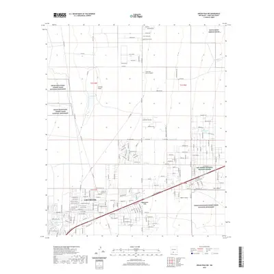
2020 Map of Organ Peak NW
USGS Topo · Published 2020About this map
Las Cruces and the planned development at Spaceport City anchor the southwestern portion of this desert landscape, where suburban expansion meets the protected expanses of the Organ Mountains-Desert Peaks National Monument. The terrain is defined by dry canyons such as Baylor Canyon and Hawkeye Canyon that drain toward the Rio Grande valley to the west. Evidence of the region’s military and conservation priorities is clear in the north and east, where the White Sands Missile Range and San Andres National Wildlife Refuge border the mountain foothills. A network of livestock water features, including Washington Tank and Creasewood Tank, are scattered across the flats, reflecting the area's ranching roots amidst modern infrastructure like El Centro Blvd and Bataan Memorial W.
Find a feature on this map
104 named features on this map. Tap any name to fly to it.
Don’t see what you’re looking for? This feature index may not catch every label — zoom into the map to look around manually.
Map Details
Editions of this 2020 Organ Peak NW Map
This is the sole edition of this map. No revisions or reprints were ever made.
Other maps of this area

1891 · Las Cruces
USGS Topo · 1:125,000

1893 · Las Cruces
USGS Topo · 1:125,000

1916 · Tonuco
USGS Topo · 1:125,000

1932 · Tonuco
USGS Topo · 1:125,000

1941 · Las Cruces
USGS Topo · 1:62,500

1941 · Organ Peak
USGS Topo · 1:62,500

1943 · Organ Peak
USGS Topo · 1:62,500

1943 · Las Cruces
USGS Topo · 1:62,500

1948 · Bear Peak
USGS Topo · 1:62,500

1948 · San Diego Mountain
USGS Topo · 1:62,500