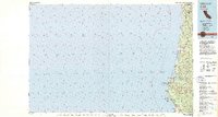
1982 Map of Orick
USGS Topo · Published 1982About this map
Redwood National Park and Prairie Creek Redwoods State Park dominate the coastal topography of this 1980s-era study of the northern California coastline. The settlement of Orick sits at the confluence of Prairie Creek and Redwood Creek, serving as a central hub for the surrounding timberlands and protected forests. Further south, a series of coastal lagoons, including Big Lagoon and Stone Lagoon, highlight the unique geological transition from the Pacific shoreline to the inland ridges.
Find a feature on this map
33 named features on this map. Tap any name to fly to it.
Don’t see what you’re looking for? This feature index may not catch every label — zoom into the map to look around manually.
Map Details
Editions of this 1982 Orick Map
This is the sole edition of this map. No revisions or reprints were ever made.
Other maps of this area

1922 · Preston Peak
USGS Topo · 1:125,000

1922 · Eureka
USGS Topo · 1:62,500

1922 · Korbel
USGS Topo · 1:62,500

1925 · Hoopa
USGS Topo · 1:125,000

1929 · Crescent City
USGS Topo · 1:125,000

1933 · Eureka
USGS Topo · 1:48,000

1942 · Eureka
USGS Topo · 1:62,500

1945 · Ship Mountain
USGS Topo · 1:62,500

1945 · Orick
USGS Topo · 1:62,500

1945 · Trinidad
USGS Topo · 1:62,500