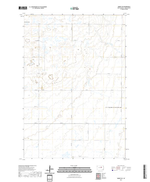
2021 Map of Orient SW
USGS Topo · Published 2021About this map
The Bald Mountains provide the dominant topographical structure for this portion of Hand County, defining the drainage patterns for the area's intermittent waterways. Small drainage channels such as Matter Cr and Shaefer Cr wind through the section lines, reflecting the typical prairie hydrology of the region. The landscape is surveyed into a precise grid, organized by townships t116n r70w, t116n r69w, t115n r70w, and t115n r69w. This layout supports a network of rural transit, with numbered corridors like 350th Ave and 180th St providing access to isolated agricultural plots. The reliance on this rigid road system, including routes like Co Rd 3 and Co Rd 25, illustrates the systematic development of South Dakota's rural interior where topography and land management intersect.
Find a feature on this map
22 named features on this map. Tap any name to fly to it.
Don’t see what you’re looking for? This feature index may not catch every label — zoom into the map to look around manually.
Map Details
Editions of this 2021 Orient SW Map
This is the sole edition of this map. No revisions or reprints were ever made.
Other maps of this area

1949 · Ree Heights NW
USGS Topo · 1:24,000

1950 · Highmore NE
USGS Topo · 1:24,000

1950 · Rezac Lake NE
USGS Topo · 1:24,000

1950 · Rezac Lake
USGS Topo · 1:24,000

1951 · Rezac Lake NE
USGS Topo · 1:24,000

1951 · Orient
USGS Topo · 1:24,000

1951 · Ree Heights NW
USGS Topo · 1:24,000

1951 · Orient SW
USGS Topo · 1:24,000

1951 · Rezac Lake
USGS Topo · 1:24,000

1951 · Polo
USGS Topo · 1:24,000