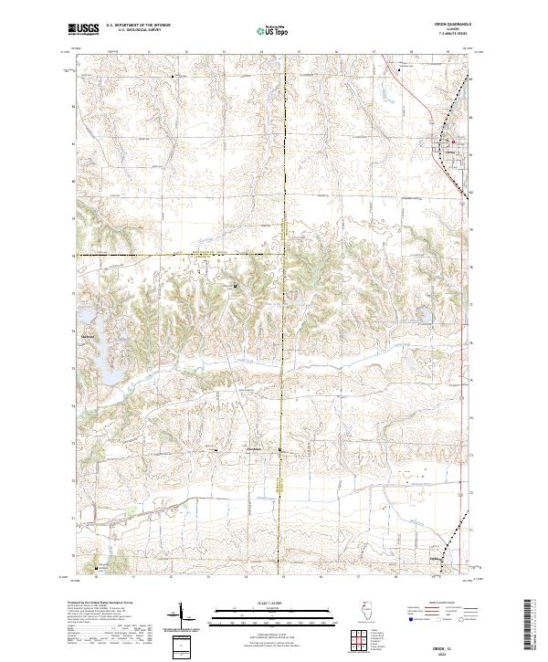
2024 Map of Orion
USGS Topo · Published 2024About this map
Orion and Sherrard anchor this Western Illinois landscape, where the agricultural plains of Henry, Rock Island, and Mercer counties meet. The terrain is defined by the incision of the Edwards River and its tributaries, including Camp Creek and Coal Creek, which create a series of gentle valleys and ridges. Small rural settlements like Swedona and Ophiem reflect the region's deep-rooted farming heritage, connected by a systematic grid of county roads such as Knoxville Rd and Sherrard Orion Rd.
Find a feature on this map
55 named features on this map. Tap any name to fly to it.
Don’t see what you’re looking for? This feature index may not catch every label — zoom into the map to look around manually.
Map Details
Editions of this 2024 Orion Map
This is the sole edition of this map. No revisions or reprints were ever made.
Other maps of this area

1912 · Milan
USGS Topo · 1:62,500

1923 · Alexis
USGS Topo · 1:62,500

1925 · Alexis
USGS Topo · 1:62,500

1937 · Orion
USGS Topo · 1:62,500

1944 · Milan
USGS Topo · 1:62,500

1947 · Woodhull
USGS Topo · 1:62,500
1948 · Milan
USGS Topo · 1:24,000

1949 · Coal Valley
USGS Topo · 1:24,000

1950 · Milan
USGS Topo · 1:24,000
1953 · Coal Valley
USGS Topo · 1:24,000