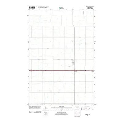
2011 Map of Oriska
USGS Topo · Published 2011About this map
Oriska stands as a focal point in this eastern North Dakota landscape, organized by a strict grid of section roads and the heavy transport corridor of Interstate 94. The small settlement is anchored by local history markers, specifically Oriska Cemetery to the north and Saint Bernards Cemetery just to the south. The surrounding terrain is defined by numerous small depressions and seasonal water bodies typical of the prairie pothole region, interspersed with a thorough network of rural routes such as 34th St SE and 128th Ave SE. Modern infrastructure is prominently displayed through the Oriska-Interchange and the Cuba-Interchange, which facilitate movement across this agricultural expanse. The map detail extends to the street level within the town, showing the arrangement of 2nd Ave and 4th St near the central residential core.
Find a feature on this map
25 named features on this map. Tap any name to fly to it.
Don’t see what you’re looking for? This feature index may not catch every label — zoom into the map to look around manually.
Map Details
Editions of this 2011 Oriska Map
This is the sole edition of this map. No revisions or reprints were ever made.
Other maps of this area

1897 · Tower
USGS Topo · 1:125,000

1952 · Grand Forks
USGS Topo · 1:250,000

1953 · Fargo
USGS Topo · 1:250,000

1956 · Fargo
USGS Topo · 1:250,000

1956 · Grand Forks
USGS Topo · 1:250,000

1961 · Valley City East
USGS Topo · 1:24,000

1965 · Tower City SW
USGS Topo · 1:24,000

1966 · Grand Forks
USGS Topo · 1:250,000

1967 · Tower City
USGS Topo · 1:24,000

1967 · Pillsbury SE
USGS Topo · 1:24,000