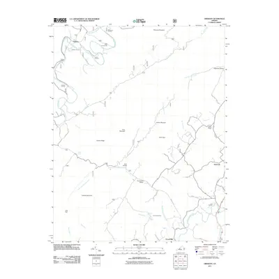
2011 Map of Oriskany
USGS Topo · Published 2011About this map
Oriskany sits along the winding path of Craig Creek in a landscape defined by prominent ridges and narrow valleys. This early 21st-century survey reveals a rural character rooted in its cemeteries and natural water sources, with family history preserved at the McKalester Cemetery, Anderson Cemetery, and Tucker Cemetery. The terrain is shaped by the towering Patterson Mountain to the north and Caldwell Mountain to the south, with the North Fork Catawba Creek and Borden Creek drainage systems cutting through the hollows. Genealogists and local historians can find traces of small communities and crossroads at Howell Mills and Flatwoods, or locate recreational landmarks like the Craig Creek Campground and Camp Montgomery. Smaller features like Sulphur Spring and Woodville Spring highlight the importance of natural springs in this corner of Botetourt County.
Find a feature on this map
47 named features on this map. Tap any name to fly to it.
Don’t see what you’re looking for? This feature index may not catch every label — zoom into the map to look around manually.
Map Details
Editions of this 2011 Oriskany Map
This is the sole edition of this map. No revisions or reprints were ever made.
Other maps of this area

1887 · Lewisburg
USGS Topo · 1:125,000

1890 · Roanoke
USGS Topo · 1:125,000

1890 · Christiansburg
USGS Topo · 1:125,000

1891 · Roanoke
USGS Topo · 1:125,000

1891 · Lewisburg
USGS Topo · 1:125,000

1894 · Natural Bridge
USGS Topo · 1:125,000

1913 · Eagle Rock
USGS Topo · 1:48,000

1915 · Eagle Rock
USGS Topo · 1:62,500

1929 · Roanoke
USGS Topo · 1:48,000

1929 · Salem
USGS Topo · 1:48,000