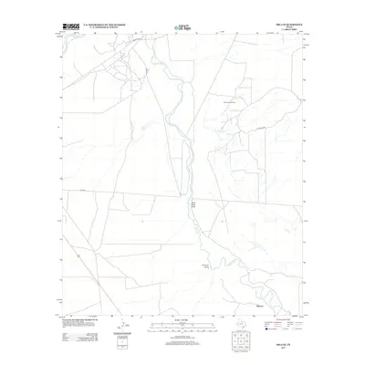
2013 Map of Orla SE
USGS Topo · Published 2013About this map
The Pecos River meanders through the arid landscape of Reeves County, serving as the primary geographic corridor for this West Texas quadrangle. In the southeastern corner, the small community of Riverton sits near the riverbanks, representing a quiet pocket of human settlement amidst the expansive desert terrain. The industrial footprint of the Permian Basin is clearly visible through the presence of the East Tunstill Oil Field, where a network of private roads like Pvt Road 3015 supports regional energy extraction.
Find a feature on this map
10 named features on this map. Tap any name to fly to it.
Don’t see what you’re looking for? This feature index may not catch every label — zoom into the map to look around manually.
Map Details
Editions of this 2013 Orla SE Map
This is the sole edition of this map. No revisions or reprints were ever made.
Other maps of this area

1925 · Orla 2-b
USGS Topo · 1:48,000

1931 · Orla
USGS Topo · 1:62,500

1954 · Pecos
USGS Topo · 1:250,000

1957 · Pecos
USGS Topo · 1:250,000

1961 · Anderson Ranch
USGS Topo · 1:24,000

1961 · Orla SE
USGS Topo · 1:24,000

1961 · Lindley Ranch
USGS Topo · 1:24,000

1961 · Narrow Bow Draw
USGS Topo · 1:24,000

1968 · Threemile Draw
USGS Topo · 1:24,000

1968 · Orla
USGS Topo · 1:24,000