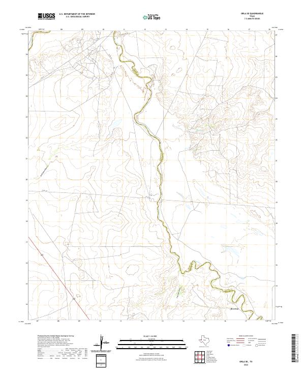
2022 Map of Orla SE
USGS Topo · Published 2022About this map
The Pecos River serves as the primary geographic and political boundary in this West Texas survey, winding through the arid landscape to divide Reeves and Loving Counties. This portion of the Trans-Pecos region is sparsely settled, with the small community of Riverton located in the southeastern corner near the riverbanks. The terrain is defined by dry watercourses and drainage features like Sand Bend Draw and Fourmile Draw, which punctuate the high desert floor.
Find a feature on this map
12 named features on this map. Tap any name to fly to it.
Don’t see what you’re looking for? This feature index may not catch every label — zoom into the map to look around manually.
Map Details
Editions of this 2022 Orla SE Map
This is the sole edition of this map. No revisions or reprints were ever made.
Other maps of this area

1925 · Orla 2-b
USGS Topo · 1:48,000

1931 · Orla
USGS Topo · 1:62,500

1954 · Pecos
USGS Topo · 1:250,000

1957 · Pecos
USGS Topo · 1:250,000

1961 · Anderson Ranch
USGS Topo · 1:24,000

1961 · Orla SE
USGS Topo · 1:24,000

1961 · Lindley Ranch
USGS Topo · 1:24,000

1961 · Narrow Bow Draw
USGS Topo · 1:24,000

1968 · Threemile Draw
USGS Topo · 1:24,000

1968 · Orla
USGS Topo · 1:24,000