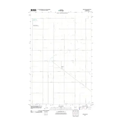
2011 Map of Orleans
USGS Topo · Published 2011About this map
Orleans stands as the primary settlement in this northern Kittson County landscape, positioned along a network of county roads just south of the Canada - United States Boundary. The terrain is defined by a dense grid of township and county highways, reflecting a highly organized agricultural layout typical of the Red River Valley region. The Little Joe River meanders across the central portion of the map, providing a natural break in the geometric road system.
Find a feature on this map
31 named features on this map. Tap any name to fly to it.
Don’t see what you’re looking for? This feature index may not catch every label — zoom into the map to look around manually.
Map Details
Editions of this 2011 Orleans Map
This is the sole edition of this map. No revisions or reprints were ever made.
Other maps of this area

1939 · Pembina
USGS Topo · 1:62,500

1941 · Hallock
USGS Topo · 1:62,500

1941 · Pembina
USGS Topo · 1:62,500

1952 · Thief River Falls
USGS Topo · 1:250,000

1956 · Thief River Falls
USGS Topo · 1:250,000

1957 · Thief River Falls
USGS Topo · 1:250,000

1967 · Thief River Falls
USGS Topo · 1:250,000
1974 · Humboldt
USGS Topo · 1:24,000
1974 · Hallock NE
USGS Topo · 1:24,000
1974 · Hill Siding
USGS Topo · 1:24,000