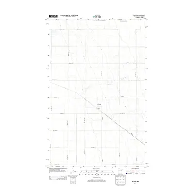
2013 Map of Orleans
USGS Topo · Published 2013About this map
Orleans occupies a central position on this northern Minnesota landscape, situated where several local routes converge in the Red River Valley region. The town is the primary settlement in an area defined by a strict section-line grid of township roads, including Twp Hwy T-112 and Twp Hwy T-224. The winding course of the Little Joe River cuts diagonally across the prairie, providing a natural contrast to the geometric precision of the surrounding agricultural lands. Mapping by the U.S. Geological Survey shows a network of county highways like Co Hwy-6 and Co Hwy-1 that connect this rural community to the broader Kittson County area. The map illustrates a late 20th-century rural infrastructure where water drainage and road access were primary concerns for the local population.
Find a feature on this map
30 named features on this map. Tap any name to fly to it.
Don’t see what you’re looking for? This feature index may not catch every label — zoom into the map to look around manually.
Map Details
Editions of this 2013 Orleans Map
This is the sole edition of this map. No revisions or reprints were ever made.
Other maps of this area

1939 · Pembina
USGS Topo · 1:62,500

1941 · Hallock
USGS Topo · 1:62,500

1941 · Pembina
USGS Topo · 1:62,500

1952 · Thief River Falls
USGS Topo · 1:250,000

1956 · Thief River Falls
USGS Topo · 1:250,000

1957 · Thief River Falls
USGS Topo · 1:250,000

1967 · Thief River Falls
USGS Topo · 1:250,000
1974 · Humboldt
USGS Topo · 1:24,000
1974 · Hallock NE
USGS Topo · 1:24,000
1974 · Hill Siding
USGS Topo · 1:24,000