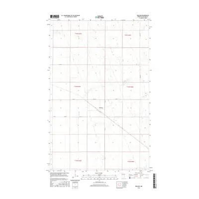
2016 Map of Orleans
USGS Topo · Published 2016About this map
Orleans stands as the primary settlement in this northern corner of Kittson County, situated at a crossroads where a linear rail corridor and local highways meet. The landscape is defined by the section lines of the Public Land Survey System, which impose a regular grid across the flat terrain of the Red River Valley region. Winding through this geometric layout is the Little Joe River, a natural watercourse that provides a stark contrast to the straight paths of Co Rd 1 and Co Rd 55. This modern topographic survey illustrates a rural community focused around its transportation links and agricultural boundaries. The convergence of local routes like Co Rd 64 and 360th St near the town center highlights the area's continued reliance on a traditional network of county roads to connect disparate farmsteads and township sections.
Find a feature on this map
15 named features on this map. Tap any name to fly to it.
Don’t see what you’re looking for? This feature index may not catch every label — zoom into the map to look around manually.
Map Details
Editions of this 2016 Orleans Map
This is the sole edition of this map. No revisions or reprints were ever made.
Other maps of this area
1939 · Pembina
USGS Topo · 1:62,500
1941 · Hallock
USGS Topo · 1:62,500
1941 · Pembina
USGS Topo · 1:62,500

1952 · Thief River Falls
USGS Topo · 1:250,000

1956 · Thief River Falls
USGS Topo · 1:250,000

1957 · Thief River Falls
USGS Topo · 1:250,000
1967 · Thief River Falls
USGS Topo · 1:250,000
1974 · Humboldt
USGS Topo · 1:24,000
1974 · Hallock NE
USGS Topo · 1:24,000
1974 · Hill Siding
USGS Topo · 1:24,000