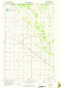
1974 Map of Orleans
USGS Topo · Published 1976About this map
The Soo Line railway cuts diagonally through this northwestern corner of Minnesota, anchoring the small settlement of Orleans in the early 1970s. This survey captures a landscape defined by the international border, where the Canada United States boundary meets the northern edge of Kittson Co. The terrain is characterized by the meandering path of the Little Joe River and the conservation lands of the Joe River State Wildlife Area, providing a distinct contrast to the surrounding agricultural grid of Clow, Richardville, Hampden, and Granville townships. The presence of a major Pipeline and a local Gravel Pit indicates the industrial and infrastructural footprint on this prairie landscape just south of Manitoba. For those studying the Red River Valley region, the map provides precise locations for local roads and section lines that have shaped the rural communities of northern Kittson County for generations.
Find a feature on this map
13 named features on this map. Tap any name to fly to it.
Don’t see what you’re looking for? This feature index may not catch every label — zoom into the map to look around manually.
Map Details
Editions of this 1974 Orleans Map
This is the sole edition of this map. No revisions or reprints were ever made.
Other maps of this area

1939 · Pembina
USGS Topo · 1:62,500

1941 · Hallock
USGS Topo · 1:62,500

1941 · Pembina
USGS Topo · 1:62,500

1952 · Thief River Falls
USGS Topo · 1:250,000

1956 · Thief River Falls
USGS Topo · 1:250,000

1957 · Thief River Falls
USGS Topo · 1:250,000

1967 · Thief River Falls
USGS Topo · 1:250,000
1974 · Humboldt
USGS Topo · 1:24,000
1974 · Hallock NE
USGS Topo · 1:24,000
1974 · Hill Siding
USGS Topo · 1:24,000