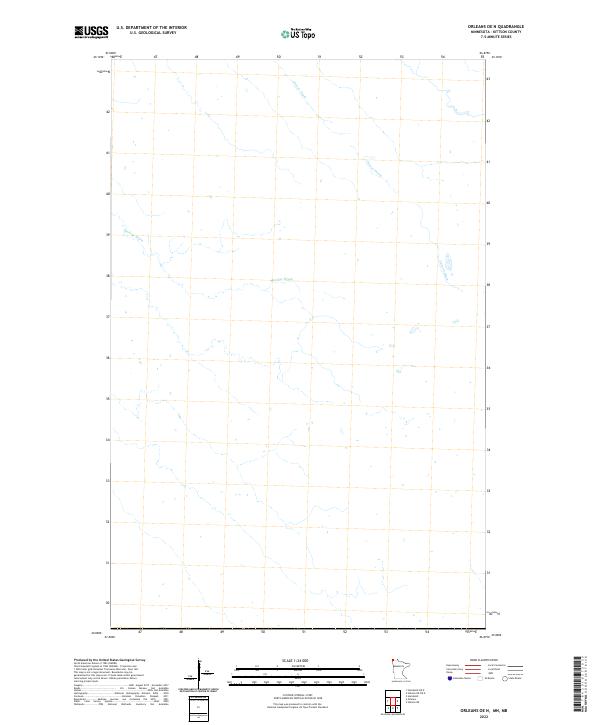
2022 Map of Orleans OE N
USGS Topo · Published 2022About this map
The northern reaches of Kittson County near the international border are defined by a sparse, flat hydrological landscape. In this 2022 U.S. Geological Survey topographic study, the terrain is marked primarily by man-made water management systems rather than natural rivers or settlements. The drainage network, featuring Harlow Drain and Casson Drain, indicates a landscape heavily modified for agricultural use, where maintaining the water table is essential for land viability. The map reveals an area devoid of named roads or buildings, emphasizing the specialized, rural character of this corner of far northwestern Minnesota.
Find a feature on this map
2 named features on this map. Tap any name to fly to it.
Don’t see what you’re looking for? This feature index may not catch every label — zoom into the map to look around manually.
Map Details
Editions of this 2022 Orleans OE N Map
This is the sole edition of this map. No revisions or reprints were ever made.
Other maps of this area

1939 · Pembina
USGS Topo · 1:62,500

1941 · Hallock
USGS Topo · 1:62,500

1941 · Pembina
USGS Topo · 1:62,500

1952 · Thief River Falls
USGS Topo · 1:250,000

1956 · Thief River Falls
USGS Topo · 1:250,000

1957 · Thief River Falls
USGS Topo · 1:250,000

1967 · Thief River Falls
USGS Topo · 1:250,000
1974 · Humboldt
USGS Topo · 1:24,000
1974 · Hallock NE
USGS Topo · 1:24,000
1974 · Orleans
USGS Topo · 1:24,000