Loading...
Loading map...2022 Map of Orlinda
USGS Topo · Published 2022About this map
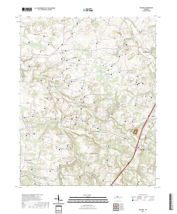
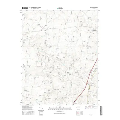
Agricultural lands and winding watercourses define this portion of Robertson and Sumner counties. The Red River and South Fork Red River carve through the landscape, creating a network of ridges and hollows such as Santee Creek Hollow and Chote Hollow. The area is notably dense with small family and community burial grounds, reflecting generations of settlement in places like Orlinda, Handleyton, and Cross Plains.
Find a feature on this map
190 named features on this map. Tap any name to fly to it.
Don’t see what you’re looking for? This feature index may not catch every label — zoom into the map to look around manually.
Map Details
Date Portrayed2022
Date Published2022
PublisherU.S. Geological Survey
Map TypeTopographic
Scale1:24,000
Physical Dimensions24 x 29 inches
Editions of this 2022 Orlinda Map
This is the sole edition of this map. No revisions or reprints were ever made.
Historical Maps of White House Through Time
6 maps found
Featured Locations
Source Details
SourceU.S. Geological Survey
CopyrightPublic Domain