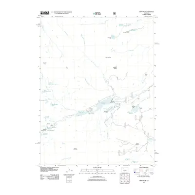
2011 Map of Orno Peak
USGS Topo · Published 2011About this map
The high-altitude hydrology of the Flat Top Mountain region is the primary focus of this topographic study, where the Bear River flows through a series of significant water management features. The landscape is defined by extensive water storage, including the Yamcolo Reservoir and Upper Stillwater Reservoir, which are supported by several dams such as Yamcolo Dam and Rams Horn Dam. This infrastructure sits amidst a network of natural alpine lakes like Blue Lake and the Twin Mandall Lakes, illustrating the importance of this watershed for the surrounding valley.
Find a feature on this map
69 named features on this map. Tap any name to fly to it.
Don’t see what you’re looking for? This feature index may not catch every label — zoom into the map to look around manually.
Map Details
Editions of this 2011 Orno Peak Map
This is the sole edition of this map. No revisions or reprints were ever made.
Other maps of this area
1927 · Glenwood Springs
USGS Topo · 1:125,000
1930 · Glenwood Springs
USGS Topo · 1:125,000

1954 · Craig
USGS Topo · 1:250,000
1957 · Craig
USGS Topo · 1:250,000

1957 · Leadville
USGS Topo · 1:250,000
1958 · Craig
USGS Topo · 1:250,000

1959 · Leadville
USGS Topo · 1:250,000
1960 · Leadville
USGS Topo · 1:250,000
1960 · Craig
USGS Topo · 1:250,000
1962 · Leadville
USGS Topo · 1:250,000