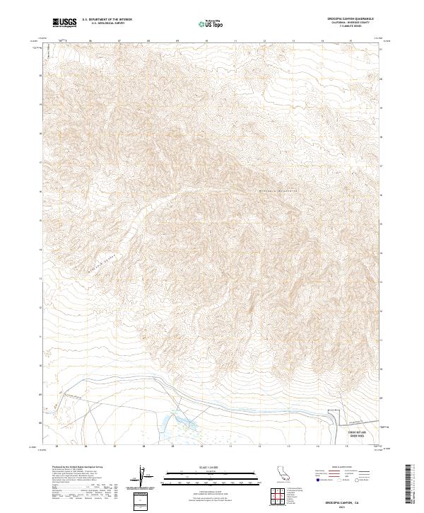
2021 Map of Orocopia Canyon
USGS Topo · Published 2021About this map
Orocopia Mountains dominate the central portion of this survey, defining a landscape of steep elevation changes and desert drainage patterns. To the northwest, the terrain levels into Shavers Valley, while the southern reaches of the map transition into the lower elevations of the Colorado Desert. This area is characterized by a significant water management footprint, most notably the Coachella Canal which traverses the southern border. The transition from the high peaks of the Orocopia range down through the winding Orocopia Canyon illustrates the complex hydrologic flow of the region. Transportation in this arid environment is limited to historical and utility-focused corridors, including the established path of Dos Palmas Spring Rd and the prominent The Bradshaw Trl, a route deeply tied to the early desert transit and mining history of Riverside County.
Find a feature on this map
12 named features on this map. Tap any name to fly to it.
Don’t see what you’re looking for? This feature index may not catch every label — zoom into the map to look around manually.
Map Details
Editions of this 2021 Orocopia Canyon Map
This is the sole edition of this map. No revisions or reprints were ever made.
Other maps of this area

1940 · Frink
USGS Topo · 1:62,500

1940 · Cottonwood Spring
USGS Topo · 1:62,500

1940 · Canyon Spring
USGS Topo · 1:62,500

1940 · Durmid
USGS Topo · 1:62,500

1943 · Canyon Spring
USGS Topo · 1:62,500

1944 · Cottonwood Spring
USGS Topo · 1:62,500

1944 · Durmid
USGS Topo · 1:62,500

1944 · Frink
USGS Topo · 1:62,500

1954 · Salton Sea
USGS Topo · 1:250,000

1955 · Salton Sea
USGS Topo · 1:250,000