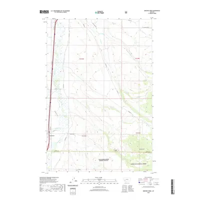
2020 Map of Orofino Creek
USGS Topo · Published 2020About this map
Racetrack sits along the western edge of the valley, marking a point of transition where the flat plains of the Clark Fork river bottom meet the rising slopes of the Deer Lodge area. The landscape is defined by its water management and diverse drainage systems, including the Valiton Ditch and several named creeks such as Dempsey Cr and Racetrack Cr that flow eastward toward the river. To the south and east, the terrain climbs into the high country of the Deerlodge National Forest, where prominent peaks like O'Donnell Mtn and Boulder Mtn overlook the canyons. The network of rural roads, such as Eastside Rd and Burnt Hollow Rd, provides access to the dissected hills and draws like Sand Hollow, illustrating the enduring ranching and forestry character of Powell County.
Find a feature on this map
34 named features on this map. Tap any name to fly to it.
Don’t see what you’re looking for? This feature index may not catch every label — zoom into the map to look around manually.
Map Details
Editions of this 2020 Orofino Creek Map
This is the sole edition of this map. No revisions or reprints were ever made.
Other maps of this area

1889 · Helena
USGS Topo · 1:250,000

1893 · Helena
USGS Topo · 1:250,000

1899 · Helena
USGS Topo · 1:250,000

1903 · Helena
USGS Topo · 1:250,000

1947 · Butte
USGS Topo · 1:250,000

1958 · Butte
USGS Topo · 1:250,000

1959 · Butte North
USGS Topo · 1:62,500

1959 · Deer Lodge
USGS Topo · 1:62,500

1960 · Butte
USGS Topo · 1:250,000

1961 · Anaconda
USGS Topo · 1:62,500