
1959 Map of Orovada
USGS Topo · Published 1961About this map
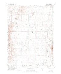
The Quinn River Valley defines this portion of the Great Basin as it appeared during the late 1950s, characterized by a sparse network of ranching outposts along the valley floor. The primary settlement at Orovada serves as a central point for the region, while outlying agricultural operations such as Willow Creek Ranch, Home Ranch, and Rebel Creek Ranch are clustered near the base of the mountains to capture seasonal runoff. To the west, the landscape rises toward Thacker Pass and Sentinel Rock, while the eastern edge is dominated by the steep slopes of the Humboldt National Forest, including the prominent Sawtooth Mtn. The hydrology of the basin is traced through the meandering courses of the Quinn River and its confluence with the Kings River, a geography that historically dictated the placement of early homesteads like Riverside Ranch and McConnell.
Find a feature on this map
41 named features on this map. Tap any name to fly to it.
Don’t see what you’re looking for? This feature index may not catch every label — zoom into the map to look around manually.
Map Details
Editions of this 1959 Orovada Map
2 editions found
Other maps of this area

1882 · Paradise
USGS Topo · 1:250,000

1886 · Disaster
USGS Topo · 1:250,000

1893 · Paradise
USGS Topo · 1:250,000

1893 · Disaster
USGS Topo · 1:250,000

1954 · Vya
USGS Topo · 1:250,000

1955 · McDermitt
USGS Topo · 1:250,000

1958 · Vya
USGS Topo · 1:250,000

1958 · Paradise Valley
USGS Topo · 1:62,500

1958 · Awakening Peak
USGS Topo · 1:62,500

1959 · McDermitt
USGS Topo · 1:250,000