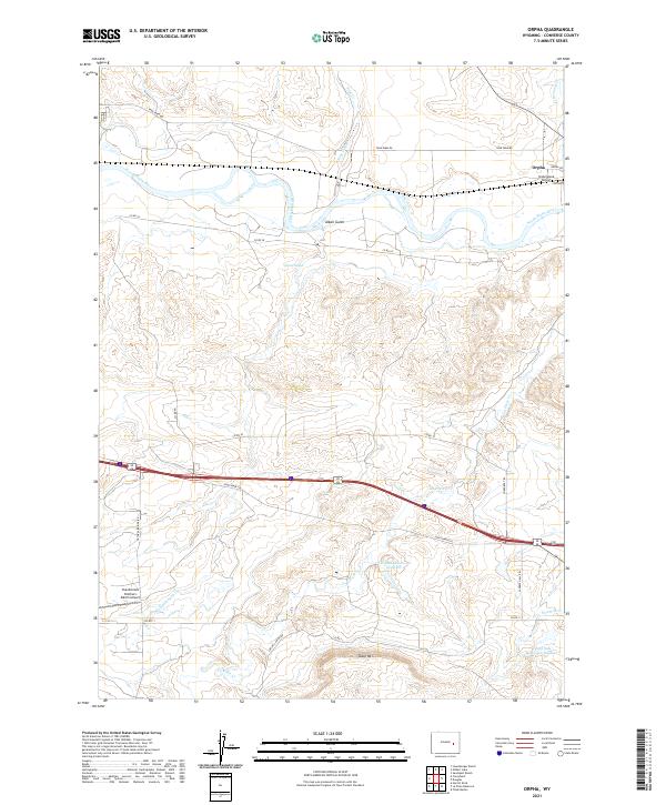
2021 Map of Orpha
USGS Topo · Published 2021About this map
The North Platte River winds through the northern portion of this landscape, carving a wide valley that includes Alkali Gulch and the curiously named Infant Geyser. The small settlement of Orpha sits near the river's bend, serving as a hub for the surrounding ranchlands. The area's aviation history and remote ranching operations are evidenced by the presence of Underwood Airport and the Chamberlain Brothers Ranch Airport, illustrating how vital air access is to this part of Converse County.
Find a feature on this map
31 named features on this map. Tap any name to fly to it.
Don’t see what you’re looking for? This feature index may not catch every label — zoom into the map to look around manually.
Map Details
Editions of this 2021 Orpha Map
This is the sole edition of this map. No revisions or reprints were ever made.
Other maps of this area

1949 · Sundquist Ranch
USGS Topo · 1:24,000

1949 · Orpha
USGS Topo · 1:24,000

1949 · Careyhurst
USGS Topo · 1:24,000

1949 · Gilbert Lake
USGS Topo · 1:24,000

1949 · Douglas
USGS Topo · 1:24,000

1949 · Leuenberger Ranch
USGS Topo · 1:24,000

1949 · Chalk Buttes
USGS Topo · 1:24,000

1950 · Careyhurst
USGS Topo · 1:24,000

1950 · Gilbert Lake
USGS Topo · 1:24,000

1950 · Leuenberger Ranch
USGS Topo · 1:24,000