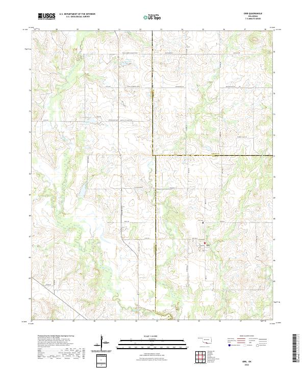
2022 Map of Orr
USGS Topo · Published 2022About this map
The settlement of Orr anchors this rural landscape at the intersection of Main St and Orr Rd W, situated where Jefferson, Carter, and Love Counties converge. This 2022 survey details a terrain defined by the winding paths of Mud Cr and its northern tributary, N Mud Cr, which snake through the western half of the quadrangle. To the east, Clear Cr and Sparks Br drain toward the south, while several engineered catchments including 067009 Reservoir and 067008 Reservoir dot the upland pastures. Genealogy researchers will find the Orr Cem north of the main village. The road network reflects the area's agricultural and ranching character, featuring evocative names like Cowboy Trail Rd, Rock Barn Rd, and Bear Hollow Rd, illustrating a deeply established rural community structure.
Find a feature on this map
46 named features on this map. Tap any name to fly to it.
Don’t see what you’re looking for? This feature index may not catch every label — zoom into the map to look around manually.
Map Details
Editions of this 2022 Orr Map
This is the sole edition of this map. No revisions or reprints were ever made.
Other maps of this area

1901 · Addington
USGS Topo · 1:125,000

1901 · Ardmore
USGS Topo · 1:125,000

1902 · Gainesville
USGS Topo · 1:125,000

1905 · Montague
USGS Topo · 1:125,000

1918 · Ardmore
USGS Topo · 1:125,000

1943 · Gainesville
USGS Topo · 1:125,000

1954 · Sherman
USGS Topo · 1:250,000

1957 · Ardmore
USGS Topo · 1:250,000

1958 · Sherman
USGS Topo · 1:250,000

1963 · Ardmore
USGS Topo · 1:250,000