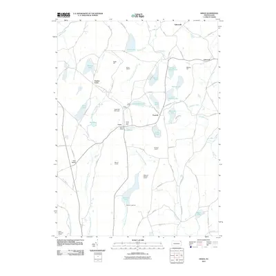
2010 Map of Orson
USGS Topo · Published 2010About this map
Mount Ararat and Sugarloaf Mountain dominate the local relief in this high-altitude corner of Susquehanna County, where the headwaters of the East Branch Lackawanna River and West Branch Lackawanna River begin their southward descent. The landscape is defined by a dense concentration of glacial lakes and ponds, including Belmont Lake, Wrighter Lake, and Independent Lake, which supported the development of small settlements like Orson and Poyntelle. These hamlets are linked by the Belmont and Ophaquaga Tpke, a corridor that also passes the Orson Cemetery. The presence of several private landing strips, such as Boden Airport, Watson Airport, and Mulligan Airport, underscores the region's character as a modern recreational and residential retreat among the ancient peaks and wetlands like Tamarack Swamp Pond.
Find a feature on this map
88 named features on this map. Tap any name to fly to it.
Don’t see what you’re looking for? This feature index may not catch every label — zoom into the map to look around manually.
Map Details
Editions of this 2010 Orson Map
This is the sole edition of this map. No revisions or reprints were ever made.
Other maps of this area

1892 · Honesdale
USGS Topo · 1:62,500

1892 · Dundaff
USGS Topo · 1:62,500

1924 · Starrucca
USGS Topo · 1:48,000

1926 · Starrucca
USGS Topo · 1:62,500

1930 · Starrucca
USGS Topo · 1:48,000

1932 · Susquehanna
USGS Topo · 1:62,500

1933 · Starrucca
USGS Topo · 1:62,500

1935 · Susquehanna
USGS Topo · 1:62,500

1943 · Honesdale
USGS Topo · 1:125,000

1946 · Forest City
USGS Topo · 1:24,000
Featured Places
- Ararat Township, PA
- Preston Township, PA
- Thompson Township, PA
- Mount Pleasant Township, PA
- Herrick Township, PA