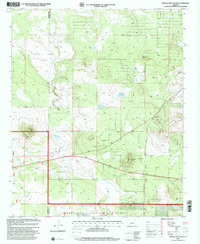
1998 Map of Ortega Mountain
USGS Topo · Published 2001About this map
Sitgreaves National Forest dominates this high-country landscape, where the boundary between Navajo and Apache counties cuts through a series of natural basins and water management features. The area is characterized by scattered upland lakes and man-made tanks used for livestock and forest management, including Ortega Lake, Baca Lake, and Sides Lake. The topography is marked by significant elevations like Dobbins Knoll and Sides Knoll, which overlook the expansive White Lakes Basin.
Find a feature on this map
21 named features on this map. Tap any name to fly to it.
Don’t see what you’re looking for? This feature index may not catch every label — zoom into the map to look around manually.
Map Details
Editions of this 1998 Ortega Mountain Map
This is the sole edition of this map. No revisions or reprints were ever made.
Other maps of this area

1886 · St Johns
USGS Topo · 1:250,000

1892 · St Johns
USGS Topo · 1:250,000

1954 · Saint Johns
USGS Topo · 1:250,000

1957 · Saint Johns
USGS Topo · 1:250,000

1958 · Saint Johns
USGS Topo · 1:250,000

1961 · McNary
USGS Topo · 1:62,500

1962 · Saint Johns
USGS Topo · 1:250,000

1968 · Boundary Butte
USGS Topo · 1:24,000
1971 · Vernon
USGS Topo · 1:24,000
1971 · Concho Lake
USGS Topo · 1:24,000