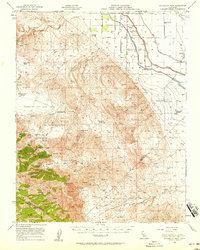
1956 Map of Ortigalita Peak
USGS Topo · Published 1958About this map
Ortigalita Peak dominates the southern landscape of this 1956 survey, marking the transition from the rugged Panoche Hills to the industrial agricultural expanse of the San Joaquin Valley. The map documents a critical era of water engineering in Merced County, showing the Delta-Mendota Canal and Main Canal cutting through the valley floor. These irrigation projects supported large operations like Hamburg Farms and the Woo Ranch, as well as local infrastructure including a Cotton Gin and a nearby Landing Strip.
Find a feature on this map
38 named features on this map. Tap any name to fly to it.
Don’t see what you’re looking for? This feature index may not catch every label — zoom into the map to look around manually.
Map Details
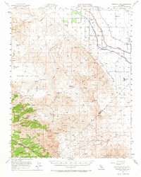
Editions of this 1956 Ortigalita Peak Map
2 editions found
Other maps of this area

1913 · Panoche
USGS Topo · 1:125,000

1916 · Delta Ranch
USGS Topo · 1:24,000

1919 · San Benito
USGS Topo · 1:62,500

1920 · Pacheco Pass
USGS Topo · 1:62,500

1920 · Carrisalito Spring
USGS Topo · 1:31,680

1921 · Volta
USGS Topo · 1:31,680

1921 · Los Banos
USGS Topo · 1:31,680

1921 · Laguna Seca Ranch
USGS Topo · 1:31,680

1921 · Tierra Loma School
USGS Topo · 1:31,680

1922 · Charleston School
USGS Topo · 1:31,680