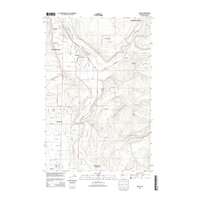
2014 Map of Orting
USGS Topo · Published 2014About this map
Orting sits at the confluence of the Carbon River and the Puyallup River, occupying a significant valley floor surrounded by rising plateaus. This 2014 survey captures a landscape of managed waterways and rural expansion, including the Puyallup River Fish Hatchery and the localized concentration of residential blocks in McMillin and Crocker. The terrain rises sharply to the east toward Spar Pole Hill and the high ground of Prairie Ridge, while the western edge reveals the suburban edges of South Hill and Graham. Significant local landmarks like the Orting Cem and Soldiers Pond are clearly marked. To the south, the map documents the more open, wooded areas around Morgan Lake and the Kapowsin Field Airport, terminating at Puyallup River Junction. The intricate grid of country roads, including Orville Rd E and Pioneer Way E, connects these disparate settlements across the Puyallup Valley.
Find a feature on this map
91 named features on this map. Tap any name to fly to it.
Don’t see what you’re looking for? This feature index may not catch every label — zoom into the map to look around manually.
Map Details
Editions of this 2014 Orting Map
This is the sole edition of this map. No revisions or reprints were ever made.
Other maps of this area

1897 · Tacoma
USGS Topo · 1:125,000

1900 · Tacoma
USGS Topo · 1:125,000

1937 · Eatonville
USGS Topo · 1:125,000

1941 · Tanwax Lake
USGS Topo · 1:62,500

1941 · Tacoma South
USGS Topo · 1:62,500

1942 · Lake Tapps
USGS Topo · 1:62,500

1944 · Lake Tapps
USGS Topo · 1:62,500

1944 · Tacoma South
USGS Topo · 1:62,500

1944 · Ohop Valley
USGS Topo · 1:62,500

1949 · Ohop Valley
USGS Topo · 1:62,500