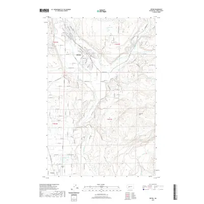
2020 Map of Orting
USGS Topo · Published 2020About this map
Orting sits at the confluence of the Puyallup River and the Carbon River, a landscape defined by its glacial river valleys and the proximity of these significant waterways. The 2020 map documents the town's grid and surrounding rural character, featuring landmarks such as the Orting Cem and Soldiers Pond. To the south, the terrain transitions toward the smaller settlement of Tanwax and the aviation-related Kapowsin Field. The complex drainage network is evident through numerous named tributaries like South Prairie Creek, Voight Cr, and Fiske Cr, while distinctive topography appears at Spar Pole Hill to the east. This survey illustrates the modern residential expansion near Orting Lake and Morgan Lake, capturing the residential development of the Pierce County interior alongside established natural features like Forest Lake and Kings Cr.
Find a feature on this map
134 named features on this map. Tap any name to fly to it.
Don’t see what you’re looking for? This feature index may not catch every label — zoom into the map to look around manually.
Map Details
Editions of this 2020 Orting Map
This is the sole edition of this map. No revisions or reprints were ever made.
Other maps of this area

1897 · Tacoma
USGS Topo · 1:125,000

1900 · Tacoma
USGS Topo · 1:125,000

1937 · Eatonville
USGS Topo · 1:125,000

1941 · Tanwax Lake
USGS Topo · 1:62,500

1941 · Tacoma South
USGS Topo · 1:62,500

1942 · Lake Tapps
USGS Topo · 1:62,500

1944 · Lake Tapps
USGS Topo · 1:62,500

1944 · Tacoma South
USGS Topo · 1:62,500

1944 · Ohop Valley
USGS Topo · 1:62,500

1949 · Ohop Valley
USGS Topo · 1:62,500