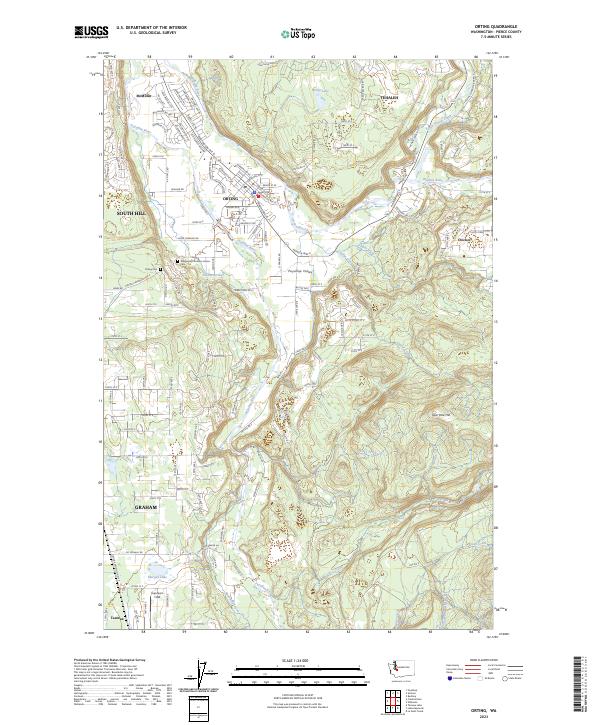
2023 Map of Orting
USGS Topo · Published 2023About this map
The Puyallup River and Carbon River converge near Orting, defining a landscape where valley floor agriculture and riverfront settlements meet the rising terrain of the Cascade foothills. This recent survey captures the modern footprint of the Puyallup Valley, illustrating the established centers of McMillin and Crocker alongside the newer residential developments of Tehaleh. Genealogy and local history are anchored by the Washington Soldiers Home Cem and the Orting Cem, while the natural geography remains dominated by water bodies like Orting Lake and the various tributaries such as Voight Creek and Beane Creek. The map provides a clear look at the region’s transport network, from the Orting Kapowsin Hwy E to the airstrip at Kapowsin Field, documenting the ongoing integration of this Pierce County corridor.
Find a feature on this map
137 named features on this map. Tap any name to fly to it.
Don’t see what you’re looking for? This feature index may not catch every label — zoom into the map to look around manually.
Map Details
Editions of this 2023 Orting Map
This is the sole edition of this map. No revisions or reprints were ever made.
Other maps of this area

1897 · Tacoma
USGS Topo · 1:125,000

1900 · Tacoma
USGS Topo · 1:125,000

1937 · Eatonville
USGS Topo · 1:125,000

1941 · Tanwax Lake
USGS Topo · 1:62,500

1941 · Tacoma South
USGS Topo · 1:62,500

1942 · Lake Tapps
USGS Topo · 1:62,500

1944 · Lake Tapps
USGS Topo · 1:62,500

1944 · Tacoma South
USGS Topo · 1:62,500

1944 · Ohop Valley
USGS Topo · 1:62,500

1949 · Ohop Valley
USGS Topo · 1:62,500