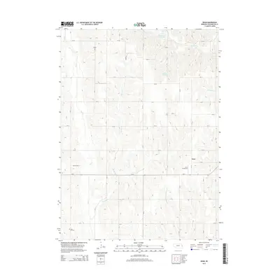
2014 Map of Orum
USGS Topo · Published 2014About this map
Orum serves as a small focal point in this agricultural landscape of Washington County, defined by a network of creeks and small upland reservoirs. The terrain is drained by several significant waterways, including Bell Cr, Little Bell Cr, and New York Cr, which flow through the rolling sections of the quadrangle. For those researching local family histories, several burial sites are clearly marked, such as Vacoma Cem in the northern portion and the distinctively named Gods Acre Cem further south. The map also highlights the area's rural aviation infrastructure with the Orum Aerodrome, located just south of the main settlement. Small-scale water management is evident through features like Mathiesen Reservoir and Sprick Reservoir, illustrating the localized irrigation and conservation efforts essential to this Nebraska farming community during the early 21st century.
Find a feature on this map
38 named features on this map. Tap any name to fly to it.
Don’t see what you’re looking for? This feature index may not catch every label — zoom into the map to look around manually.
Map Details
Editions of this 2014 Orum Map
This is the sole edition of this map. No revisions or reprints were ever made.
Other maps of this area

1893 · Fremont
USGS Topo · 1:125,000

1896 · Fremont
USGS Topo · 1:125,000

1955 · Fremont
USGS Topo · 1:250,000

1957 · Fremont
USGS Topo · 1:250,000

1958 · Fremont
USGS Topo · 1:250,000

1966 · Nickerson
USGS Topo · 1:24,000

1966 · Nickerson NW
USGS Topo · 1:24,000

1968 · Fremont East
USGS Topo · 1:24,000

1968 · Kennard
USGS Topo · 1:24,000
1968 · Arlington
USGS Topo · 1:24,000