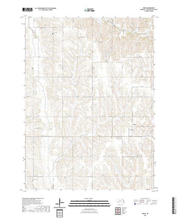
2021 Map of Orum
USGS Topo · Published 2021About this map
Agricultural lands and winding watercourses define this section of Washington County, centered on the small community of Orum. The landscape is a network of section-line roads and creek valleys, where the headwaters of Big Papillion Cr and the Northwest Br Papillion Cr begin their southward trek. For those tracing family history in the area, the map preserves the locations of Vacoma Cem in the north and Gods Acre Cem further south, providing essential geographic context for early prairie settlements. Local infrastructure is represented by the Orum Aerodrome and several upland water features, including Mathiesen Reservoir and Sprick Reservoir. The drainage patterns of Bell Cr and Little Bell Cr illustrate the undulating terrain that challenged early farmers and road builders in this part of eastern Nebraska.
Find a feature on this map
37 named features on this map. Tap any name to fly to it.
Don’t see what you’re looking for? This feature index may not catch every label — zoom into the map to look around manually.
Map Details
Editions of this 2021 Orum Map
This is the sole edition of this map. No revisions or reprints were ever made.
Other maps of this area

1893 · Fremont
USGS Topo · 1:125,000

1896 · Fremont
USGS Topo · 1:125,000

1955 · Fremont
USGS Topo · 1:250,000

1957 · Fremont
USGS Topo · 1:250,000

1958 · Fremont
USGS Topo · 1:250,000

1966 · Nickerson
USGS Topo · 1:24,000

1966 · Nickerson NW
USGS Topo · 1:24,000

1968 · Fremont East
USGS Topo · 1:24,000

1968 · Kennard
USGS Topo · 1:24,000
1968 · Arlington
USGS Topo · 1:24,000