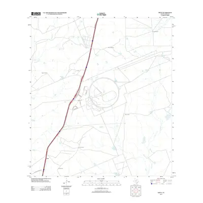
2013 Map of Orvil
USGS Topo · Published 2013About this map
Orvil and its surrounding ranchland north of Laredo reflect a landscape defined by industrial development and traditional water management. The map reveals a transition where sprawling road networks like Killam Industrial Blvd and Uniroyal Dr meet the older agrarian footprint of Webb County. This territory relies on a sophisticated system of windmills and tanks to support life in the arid brush country, with several named landmarks such as Macana Windmill, El Jano Windmill, and La Coma Windmill serving as essential points of reference. Drainages like Sombrerito Cr and Chacon Cr cut through the terrain, while large reservoirs like La Presa Grande provide significant water storage. The presence of specialized street names such as Carriers Dr and Port Dr underscores the area's growing role as a logistics and transportation hub near the international border.
Find a feature on this map
31 named features on this map. Tap any name to fly to it.
Don’t see what you’re looking for? This feature index may not catch every label — zoom into the map to look around manually.
Map Details
Editions of this 2013 Orvil Map
This is the sole edition of this map. No revisions or reprints were ever made.
Other maps of this area

1956 · Las Tiendas
USGS Topo · 1:62,500

1956 · Islitas
USGS Topo · 1:62,500

1956 · Laredo East
USGS Topo · 1:62,500

1956 · Webb
USGS Topo · 1:62,500

1956 · Laredo
USGS Topo · 1:250,000

1965 · Laredo West
USGS Topo · 1:24,000

1965 · Orvil
USGS Topo · 1:24,000

1965 · Cuervo Creek
USGS Topo · 1:24,000

1965 · Cibolo Ranch
USGS Topo · 1:24,000

1965 · Nido Ranch
USGS Topo · 1:24,000