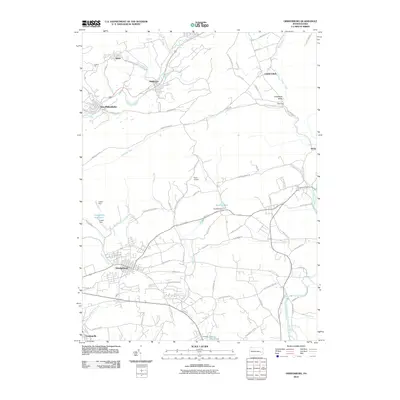
2010 Map of Orwigsburg
USGS Topo · Published 2010About this map
Orwigsburg and the surrounding coal region of Schuylkill County are defined by a complex network of ridges and watercourses. This landscape is shaped by the Schuylkill River in the north and the Little Schuylkill River to the east, while the borough of Orwigsburg sits at the base of Second Mountain. Local water management is evident through the Orwigsburg Reservoir, supported by both an upper and Lower Dam. Small settlements such as Kaska, Middleport, and New Philadelphia follow the river valley, connected by historic thoroughfares like New Philadelphia Rd. The presence of Neon Airport and several dams, including Kunkles Dam and Yost Dam, highlight the region's infrastructure, while prominent terrain features like Tucker Hill and Coal Mountain Rd reflect the industrial heritage of the Pennsylvania anthracite country.
Find a feature on this map
71 named features on this map. Tap any name to fly to it.
Don’t see what you’re looking for? This feature index may not catch every label — zoom into the map to look around manually.
Map Details
Editions of this 2010 Orwigsburg Map
This is the sole edition of this map. No revisions or reprints were ever made.
Other maps of this area

1889 · Hazleton
USGS Topo · 1:62,500

1889 · Pottsville
USGS Topo · 1:62,500

1891 · Hazleton
USGS Topo · 1:62,500

1891 · Pottsville
USGS Topo · 1:62,500

1892 · Mahanoy
USGS Topo · 1:62,500

1893 · Hazleton
USGS Topo · 1:62,500

1893 · Mahanoy
USGS Topo · 1:62,500

1909 · Hamburg
USGS Topo · 1:62,500

1911 · Hamburg
USGS Topo · 1:62,500

1944 · Pottsville
USGS Topo · 1:24,000
Featured Places
- Orwigsburg, PA
- New Philadelphia, PA
- Deer Lake, West Brunswick Township
- Middleport, PA
- North Manheim Township, PA