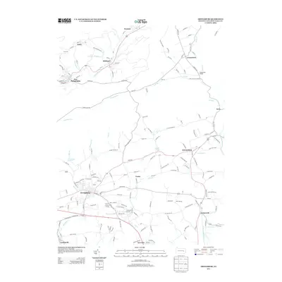
2013 Map of Orwigsburg
USGS Topo · Published 2013About this map
The Schuylkill River valley serves as a primary corridor through this part of Schuylkill County, where industrial history meets the ridge-and-valley landscape. Established settlements like Orwigsburg and New Philadelphia anchor the map, showing the dense street grids and proximity to the water that defined early Pennsylvania development. The map traces several distinct waterways, including the Little Schuylkill River and Tumbling Run, which carve through the terrain between local heights like Tucker Hill. Cultural and civic landmarks are well-preserved in the record, notably the Red Church and the Orwigsburg Reservoir. Small clusters such as Middleport, McKeansburg, and Kaska are mapped in detail, reflecting the era's transition toward modern infrastructure while maintaining their traditional town layouts near the historic coal and transport routes.
Find a feature on this map
157 named features on this map. Tap any name to fly to it.
Don’t see what you’re looking for? This feature index may not catch every label — zoom into the map to look around manually.
Map Details
Editions of this 2013 Orwigsburg Map
This is the sole edition of this map. No revisions or reprints were ever made.
Other maps of this area

1889 · Hazleton
USGS Topo · 1:62,500

1889 · Pottsville
USGS Topo · 1:62,500

1891 · Hazleton
USGS Topo · 1:62,500

1891 · Pottsville
USGS Topo · 1:62,500

1892 · Mahanoy
USGS Topo · 1:62,500

1893 · Hazleton
USGS Topo · 1:62,500

1893 · Mahanoy
USGS Topo · 1:62,500

1909 · Hamburg
USGS Topo · 1:62,500

1911 · Hamburg
USGS Topo · 1:62,500

1944 · Pottsville
USGS Topo · 1:24,000
Featured Places
- Orwigsburg, PA
- New Philadelphia, PA
- Deer Lake, West Brunswick Township
- Middleport, PA
- North Manheim Township, PA