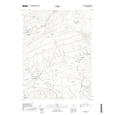
2019 Map of Orwigsburg
USGS Topo · Published 2019About this map
Orwigsburg serves as the focal point of this Schuylkill County landscape, where the valley floor transitions into the prominent ridges of Second Mountain and Blue Mountain. The settlement pattern reflects a deeply rooted community structure, evidenced by the numerous church cemeteries that anchor smaller hamlets, such as Saint Mary's Greek Catholic Cem near Middleport and the Friedens Lutheran Cem in New Ringgold. Water management and natural drainage are central to the area's geography, with the Schuylkill River and Little Schuylkill River carving paths through the terrain alongside engineered features like the Orwigsburg Reservoir and Kunkles Dam. The network of local roads, including Valley Rd and the State Gamelands Access Rd, reveals how the community navigates the high-relief topography. This map documents a region where agricultural valleys and residential clusters remain closely tied to the steep wooded slopes of the Appalachian ridges.
Find a feature on this map
133 named features on this map. Tap any name to fly to it.
Don’t see what you’re looking for? This feature index may not catch every label — zoom into the map to look around manually.
Map Details
Editions of this 2019 Orwigsburg Map
This is the sole edition of this map. No revisions or reprints were ever made.
Other maps of this area

1889 · Hazleton
USGS Topo · 1:62,500

1889 · Pottsville
USGS Topo · 1:62,500

1891 · Hazleton
USGS Topo · 1:62,500

1891 · Pottsville
USGS Topo · 1:62,500

1892 · Mahanoy
USGS Topo · 1:62,500

1893 · Hazleton
USGS Topo · 1:62,500

1893 · Mahanoy
USGS Topo · 1:62,500

1909 · Hamburg
USGS Topo · 1:62,500

1911 · Hamburg
USGS Topo · 1:62,500

1944 · Pottsville
USGS Topo · 1:24,000
Featured Places
- Orwigsburg, PA
- New Philadelphia, PA
- Deer Lake, West Brunswick Township
- Middleport, PA
- North Manheim Township, PA